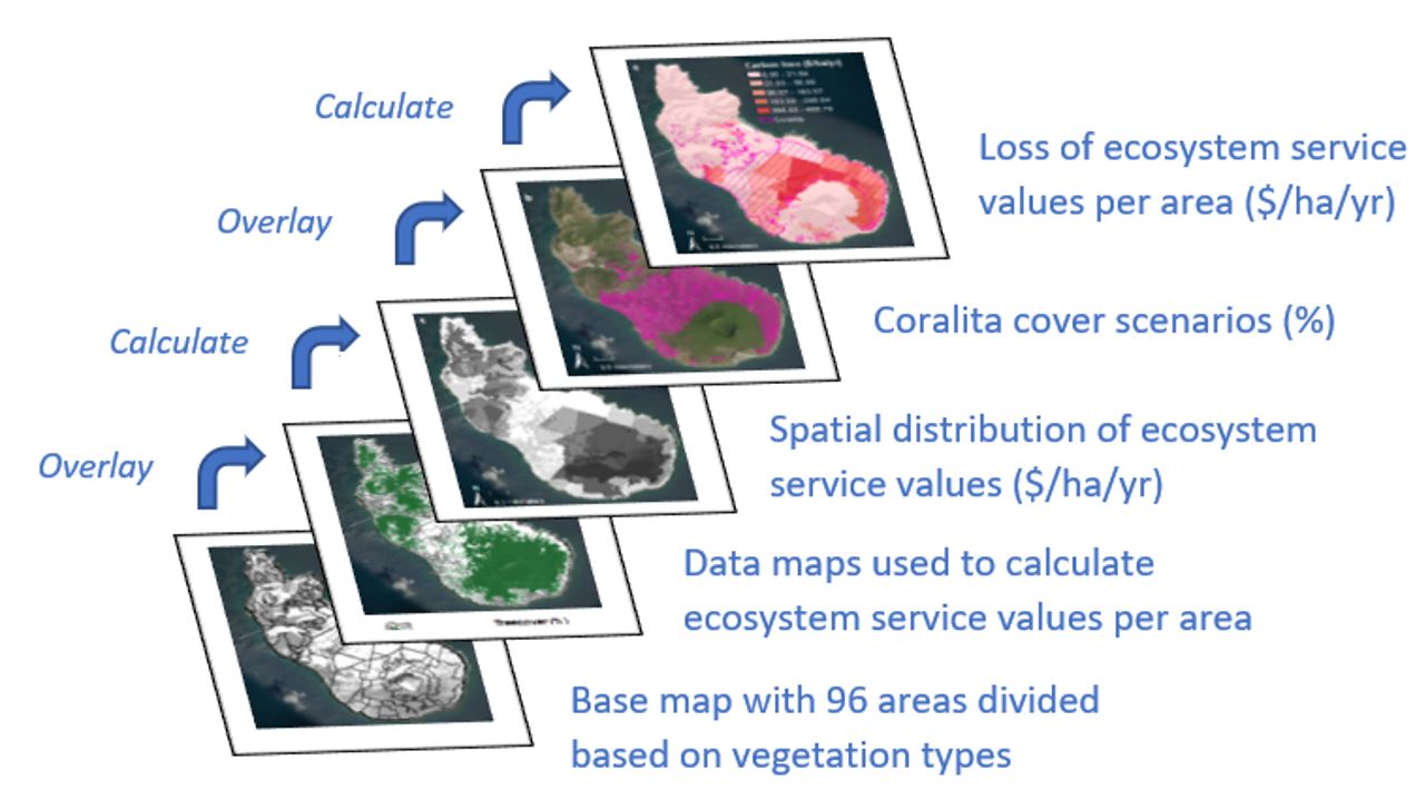
Schematic overview of the general steps of the mapping methodology used to calculate and map the loss of ecosystem service values due to Coralita presence on St. Eustatius. The data maps used to build the ecosystem service layers differ per ecosystem service. The overlay of each Coralita cover scenario with the ecosystem service layers resulted in a map of the loss of ecosystem service values. Units are percentage (%) and USD per hectare per year ($/ha/yr).