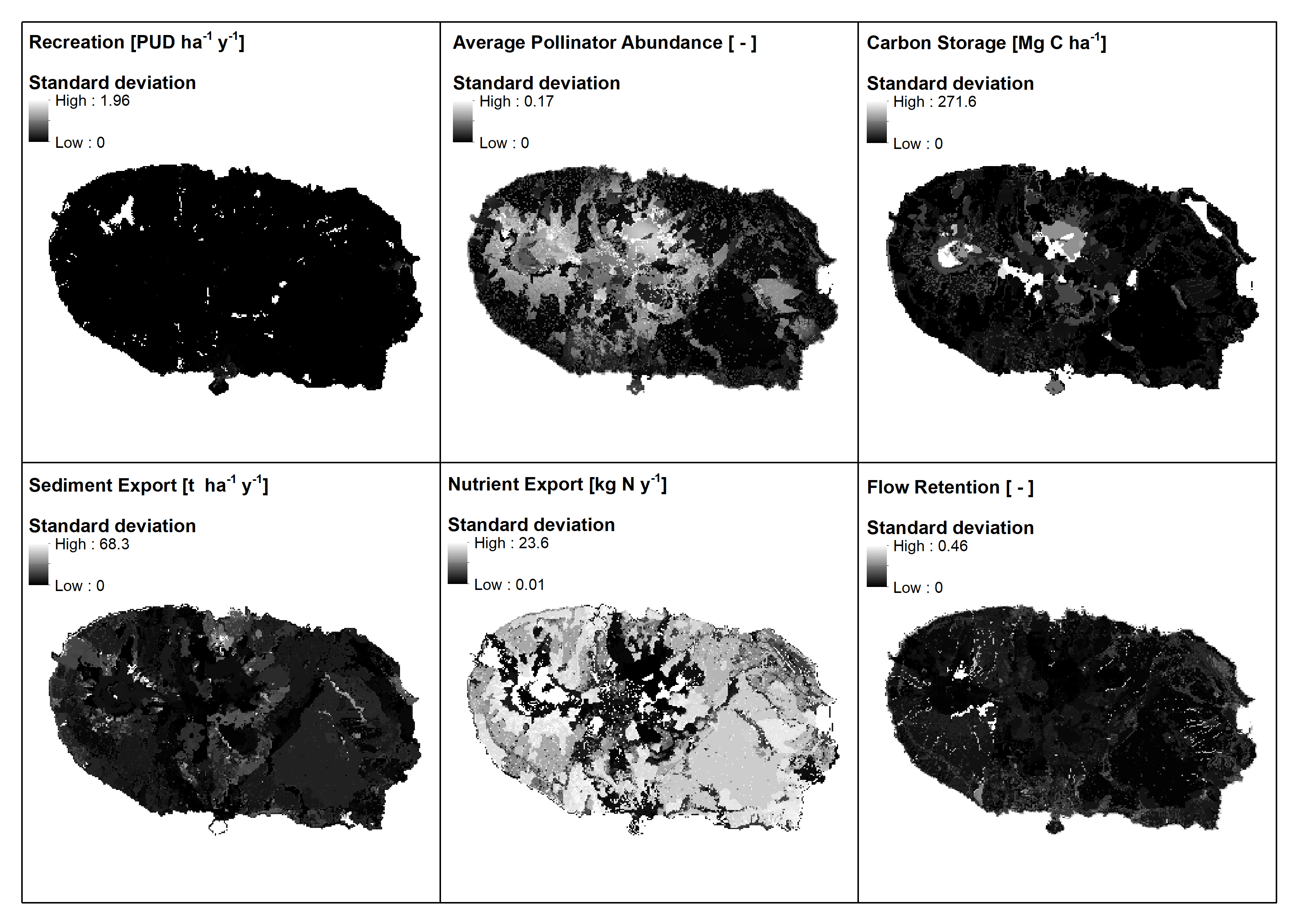
Spatial distribution of dissimilarities for each InVEST module, based on standard deviations per raster cell for all three input LULC datasets: CORINE, COS.A and Sentinel-2-based map.
|
|
||
|
Spatial distribution of dissimilarities for each InVEST module, based on standard deviations per raster cell for all three input LULC datasets: CORINE, COS.A and Sentinel-2-based map. |
||
| Part of: Sieber IM, Hinsch M, Vergílio M, Gil A, Burkhard B (2021) Assessing the effects of different land-use/land-cover input datasets on modelling and mapping terrestrial ecosystem services - Case study Terceira Island (Azores, Portugal). One Ecosystem 6: e69119. https://doi.org/10.3897/oneeco.6.e69119 |