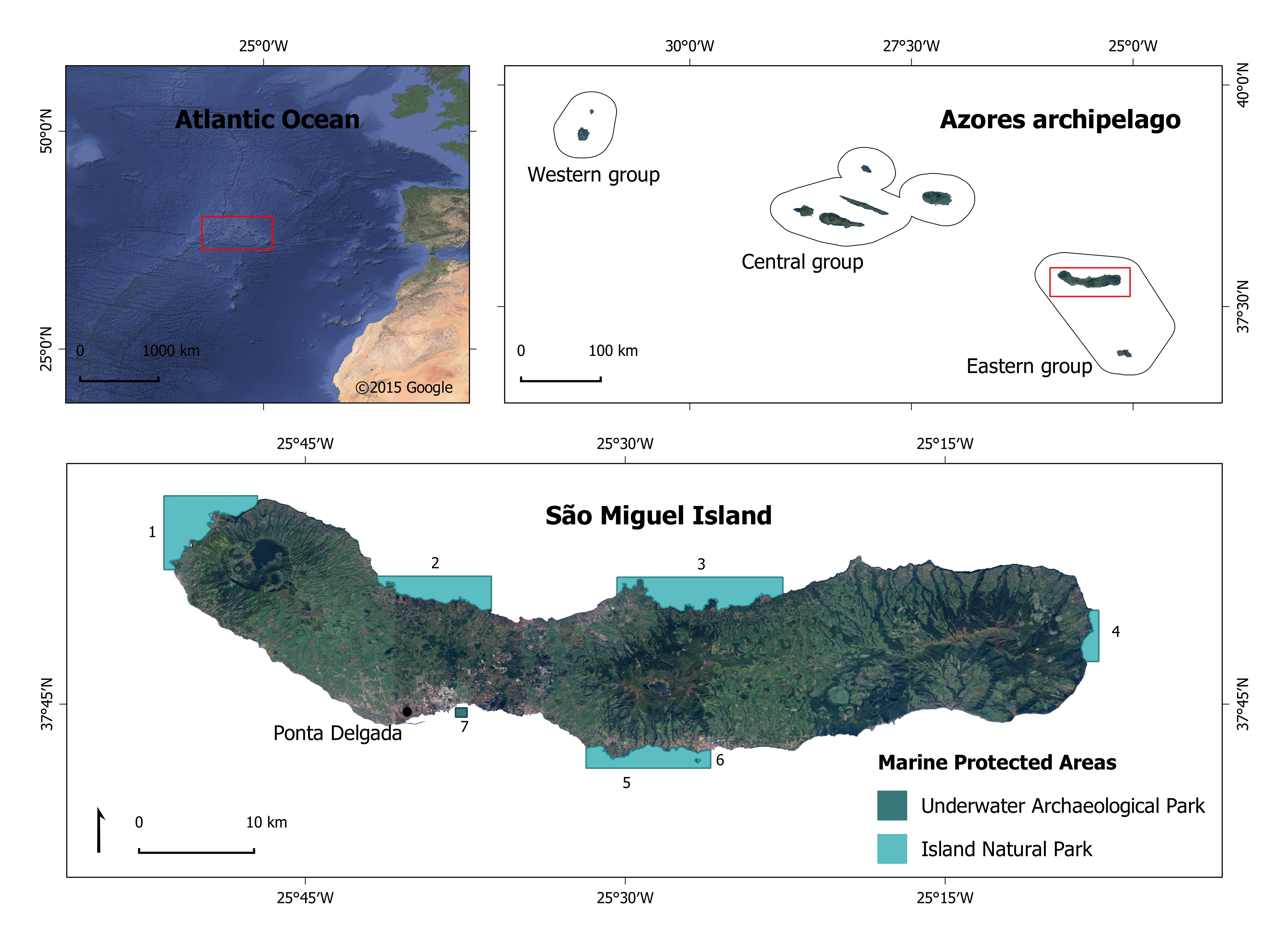
Geographic location of São Miguel within the Azores Archipelago and the North Atlantic Ocean (top) and coastal MPAs (bottom): 1. Ponta da Ferraria - Ponta da Bretanha, IUCN cat. VI; 2. Porto das Capelas - Ponta da Bretanha, IUCN cat. VI; 3. Ponta do Cintrão - Ponta da Maia, IUCN cat. VI; 4. Costa Este, IUCN cat. VI; 5. Caloura - Ilhéu de Vila Franca, IUCN cat. VI; 6. Ilhéu de Vila Franca, IUCN cat. IV; 7. Dori. (Source: SIGMAR)