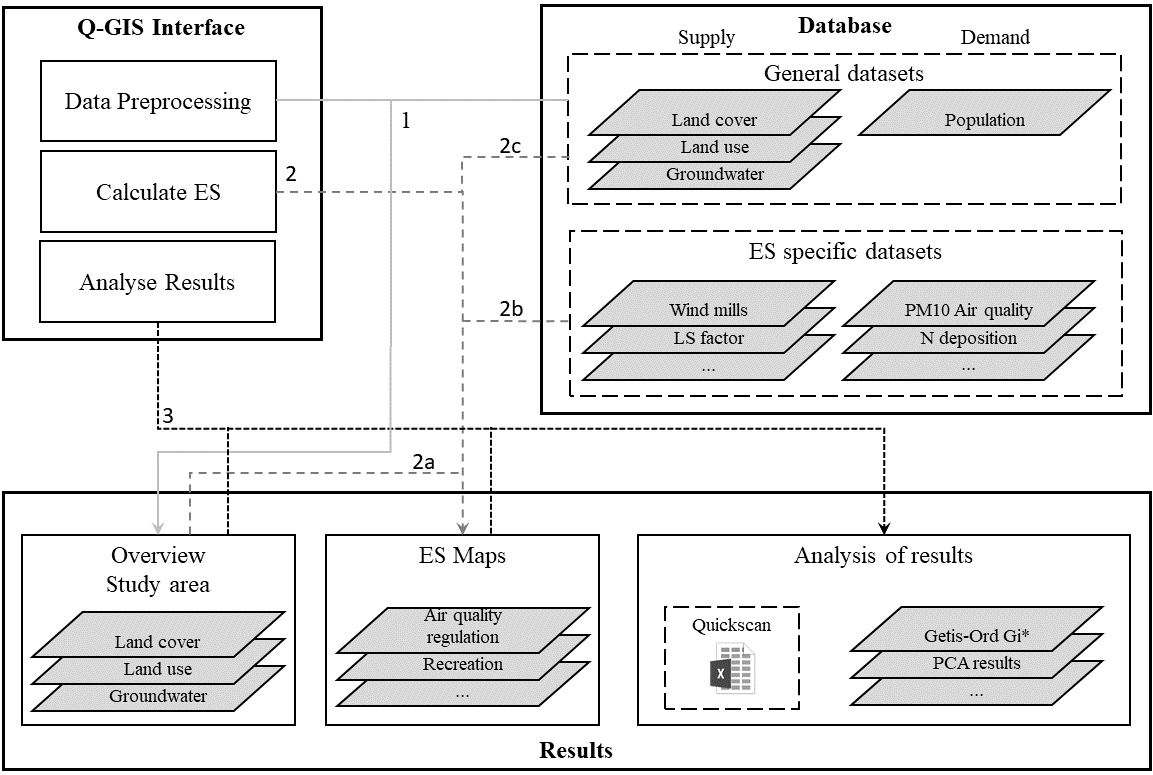
General overview of the various data processing stages and functionalities that the ECOPLAN-SE features.
- During data preprocessing, data from the general geodataset are extracted at study area level. Datasets can be adjusted to develop LC and LU scenarios using available modules.
- ES are calculated using the data on (a) study area level. (b) Additional, ES specific data can be incorporated from the geodataset when needed, including both demand and supply-related files. (c) When flows are taken into account, the plug-in will automatically increase the area that is evaluated to also include the relevant areas outside of the study area.
- ES maps are processed to obtain comprehensible, aggregated results in tables and hot-spot and bundle maps.