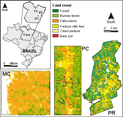
Location of Pará State and the study sites of Maçaranduba (MC), Pacajá (PC) and Palmares II (PR). Coloured areas in the maps represent land use of the study sites in 2007.
|
|
||
|
Location of Pará State and the study sites of Maçaranduba (MC), Pacajá (PC) and Palmares II (PR). Coloured areas in the maps represent land use of the study sites in 2007. |
||
| Part of: Le Clec'h S, Dufour S, Bucheli J, Grimaldi M, Huber R, Miranda I, Mitja D, Silva Costa L, Oszwald J (2019) Uncertainty in ecosystem services maps: the case of carbon stocks in the Brazilian Amazon forest using regression analysis. One Ecosystem 4: e28720. https://doi.org/10.3897/oneeco.4.e28720 |