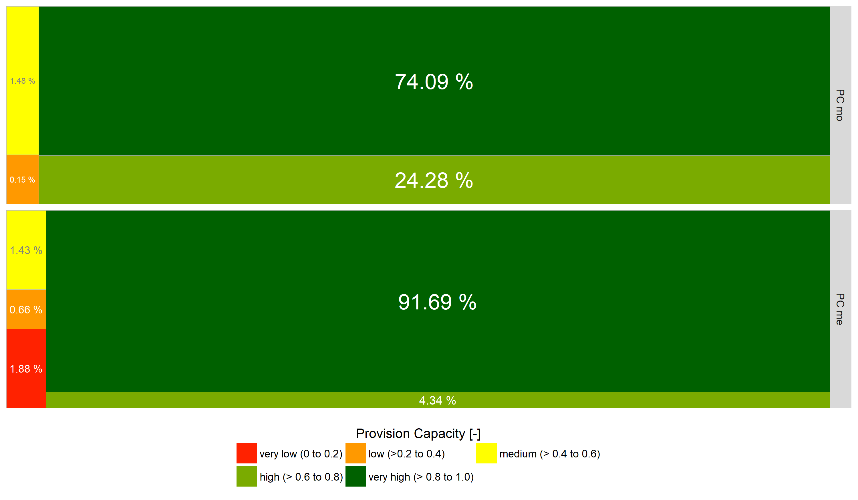
Areal proportions of the soil erosion indicators describing the provision capacity (PCmo: based on modelled actual soil loss data; PCme: based on mapped actual soil loss data). The treemaps visualise the proportions of the provision capacity classes for the whole investigation area.