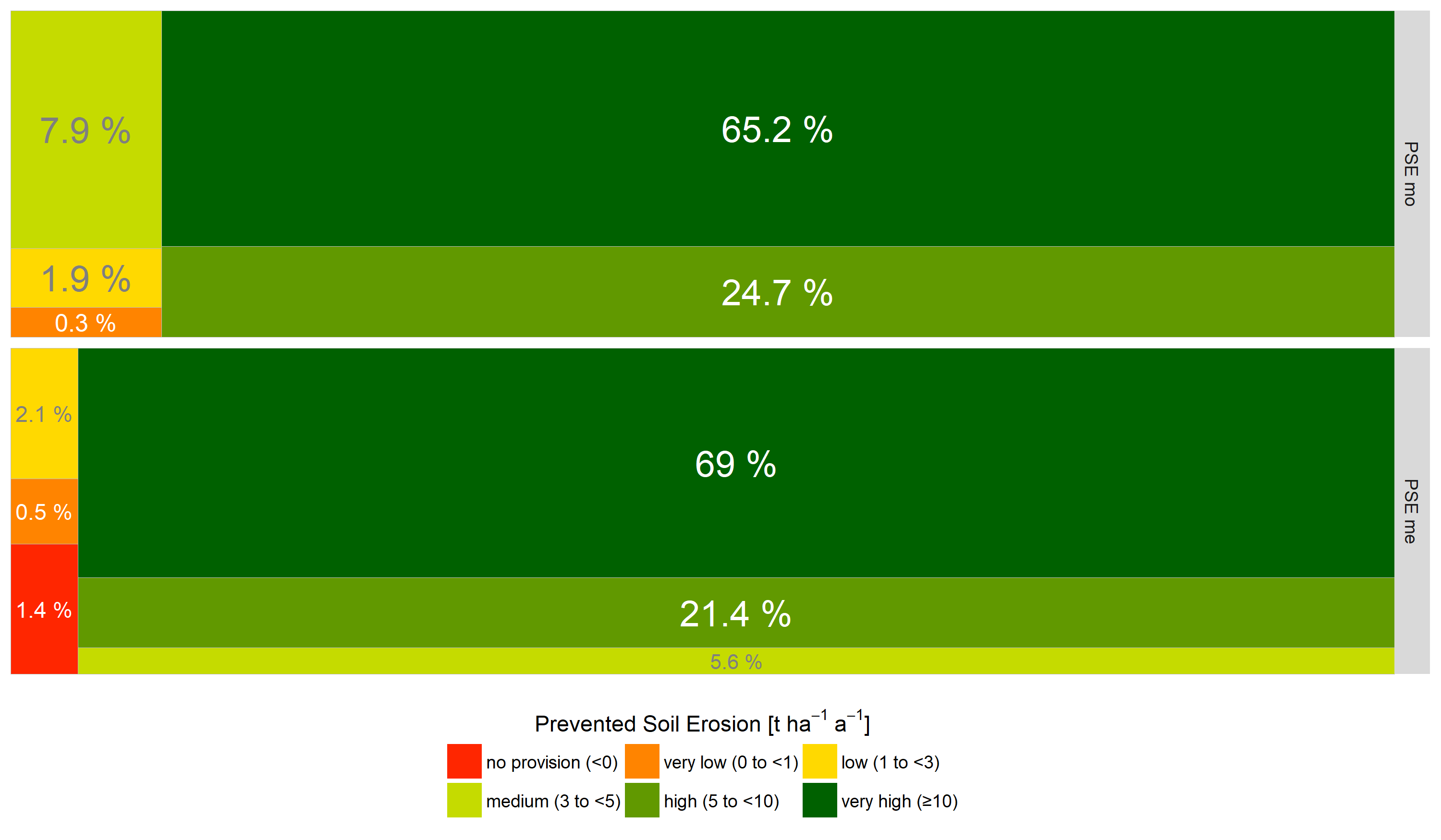
Area proportions of the soil erosion indicators describing the prevented soil erosion (PSEmo: based on modelled actual soil loss data: based on measured actual soil loss data: PSEme). The treemaps visualise the proportions of soil loss classes for the whole investigation area.