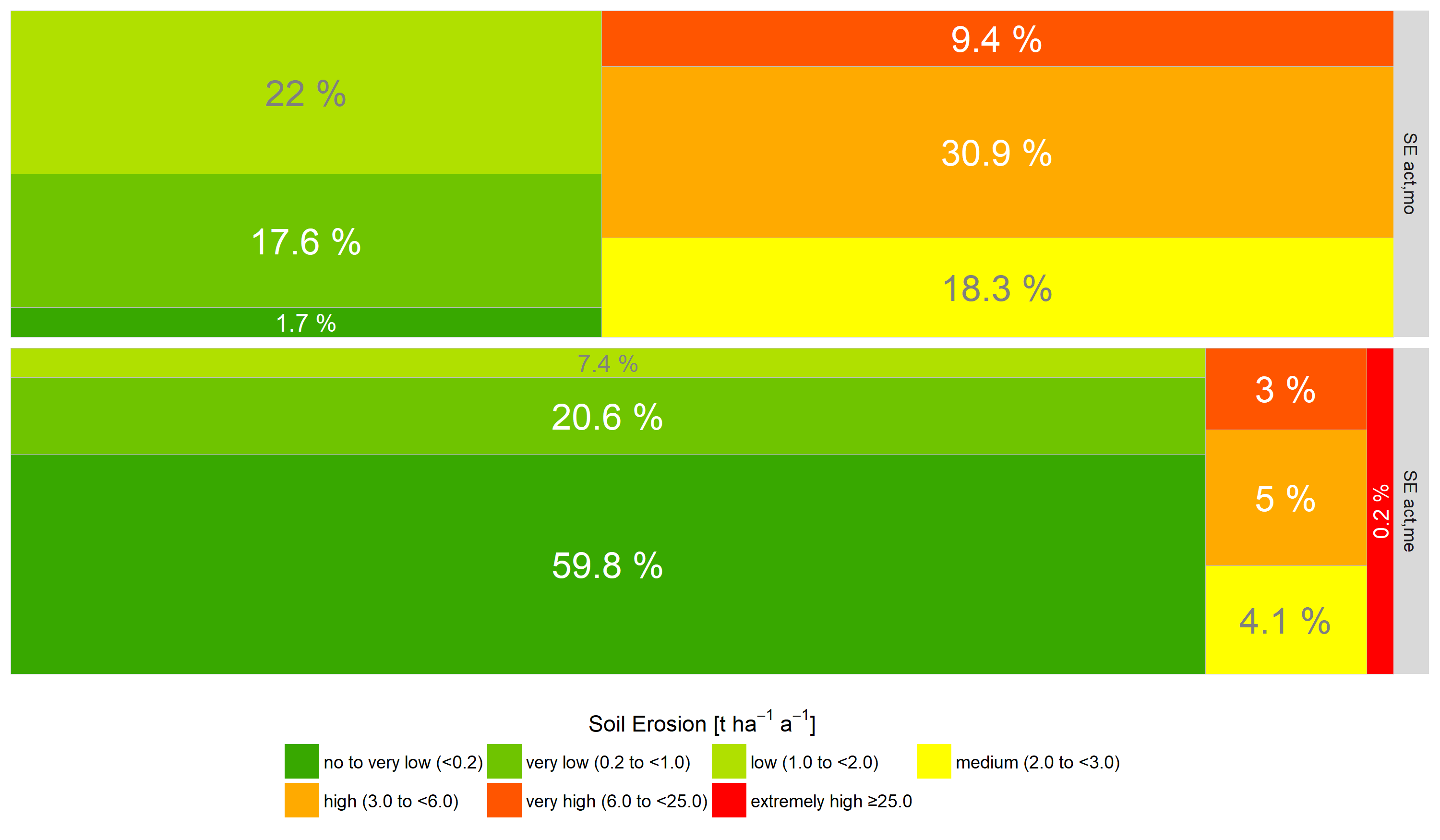
Area proportions of the soil erosion indicators for the mitigated structural impact (SEact,mo: based on modelled actual soil loss data; SEact,me: based on measured actual soil loss data). The treemaps visualise the proportions of soil loss classes for the whole investigation area.