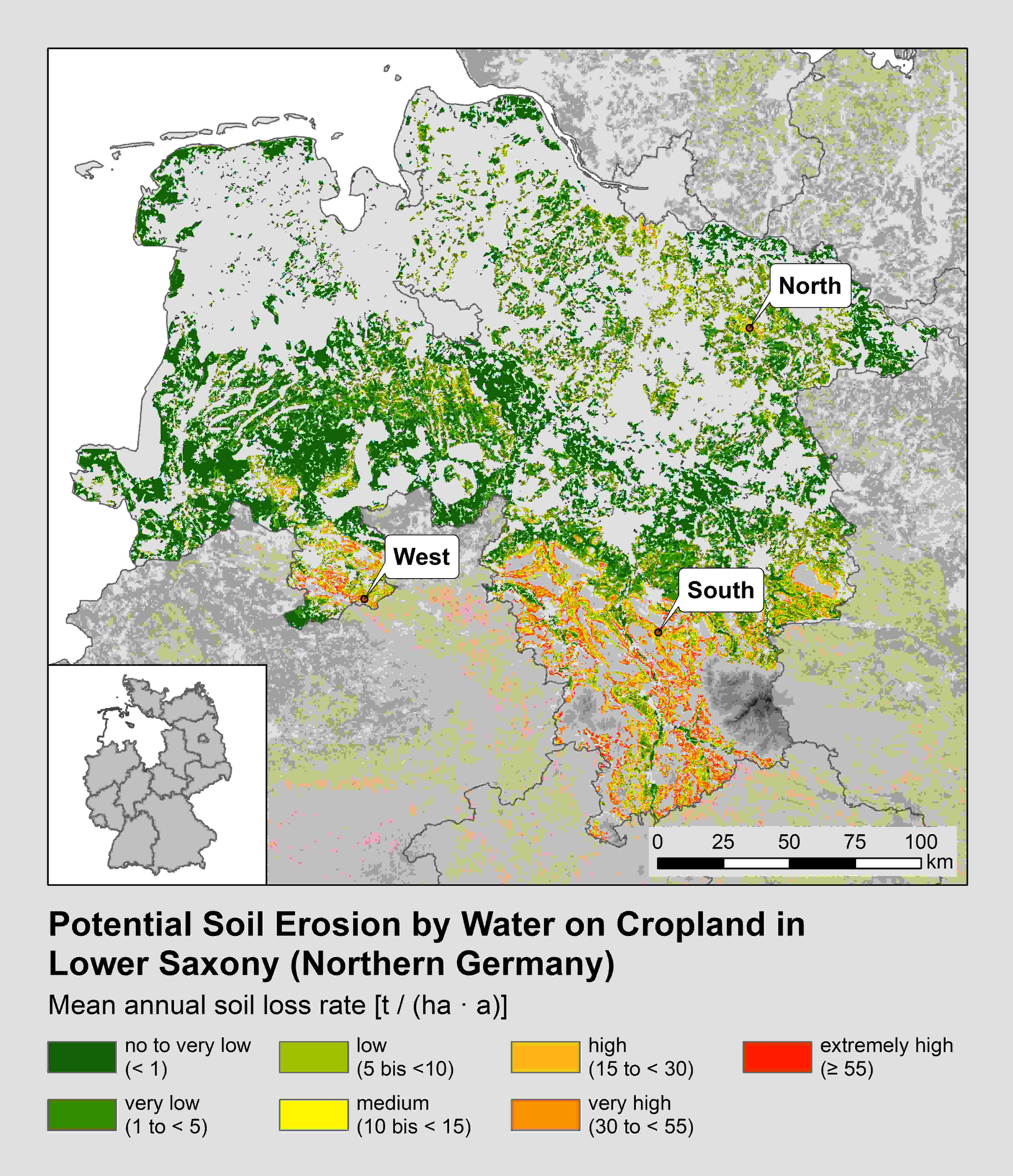
Potential soil erosion by water on cropland in Lower Saxony (Northern Germany) and location of the investigation regions of this study. Data: Map of the potential erosion risk of agricultural soils by water in Germany (Scale 1 : 1.000.0000). Federal Institute for Geosciences and Natural Resources (BGR) 2014.