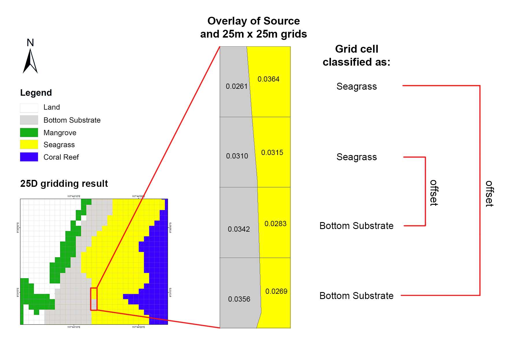
Four vertically adjacent grids representing a boundary of Ecosystem Assets, sampled from 25D (25 x 25 m2 grids with dominance method) result. The overlay of Source and 25 x 25 m2 grids are labelled with numbers denoting the area (ha) of the Source’s Ecosystem Assets (i.e. seagrass and bottom substrate) contained within each grid.